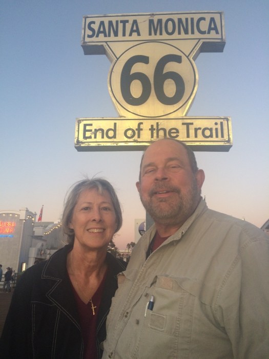
 On the Pier, Santa Monica, CA On the Pier, Santa Monica, CA |
Victorville, CA to the End of The Trail
When we checked out of the hotel in Victorville, the desk clerk kept talking about how cold it was. And when we stepped outside, sure enough our car was covered with frost. But though the air was cool (50 degrees), there was no breeze and the sun was bright and quite warm. As for the car, it had been parked in the shade and the frost quickly left while we were loading up. We decided Southern Californians (or at least the desk clerk) really weren’t aware of what cold really meant, so we put the top down and kept it down all day. It was the right choice; the temperature went into the 70s.
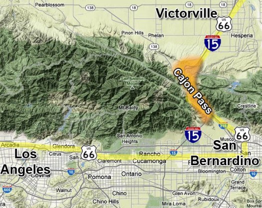
A quick breakfast and then on toward the Cajon Pass. In this area, I-15 tracks the old Route 66 path into the Cajon Pass, which drops from the high desert down into the valley.
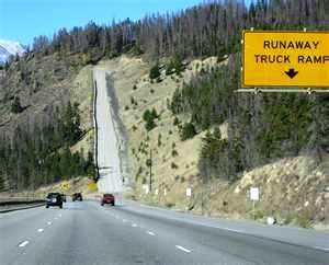 Coming in from the east, we were already much higher than the valley so there was little climbing on our end. Coming over the Pass though, the road is long, downhill, and very fast. I was up to about 80 mph and passing nobody, while a more than a few vehicles were passing me. We saw a sign saying “Safety Chute for Runaway Trucks – 2 miles.” If you had a runaway truck, I wondered, what you were supposed to do for the next two miles?
I also wondered about the early travelers going over the Pass and heading downhill in a HURRY. Here is a photo of El Cajon Pass in 1923.
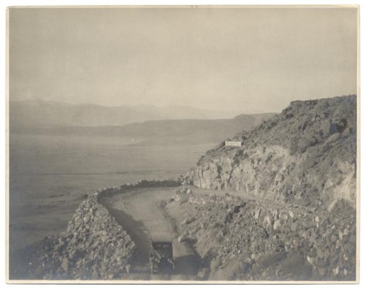 I expect there were brake-repair shops lining Route 66 both at the top and the bottom of the Pass.
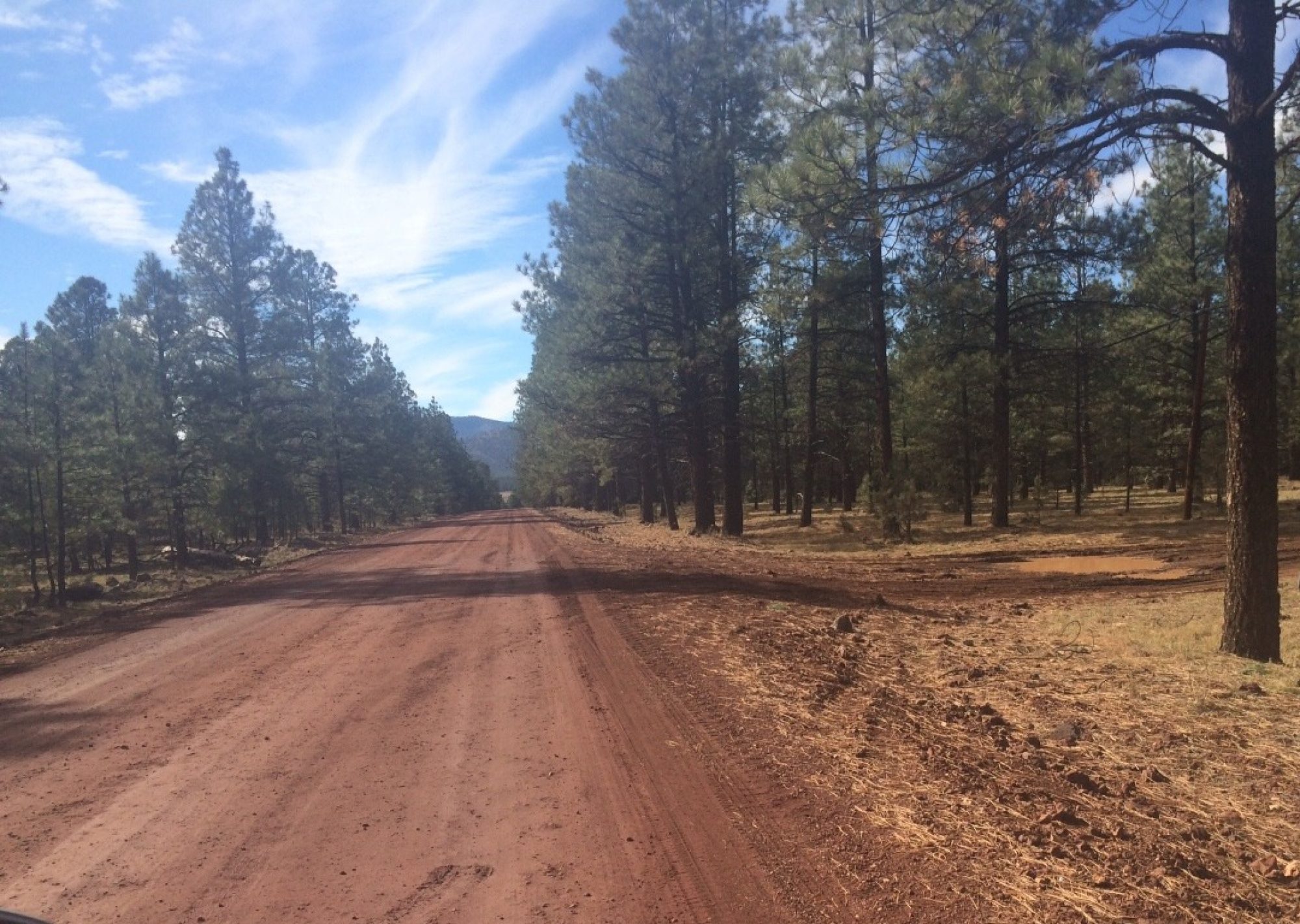
Just over El Cajon Pass, we immediately took the old route via the Cleghorn exit. Within the space of a half-mile we went back in time about 70 years. Above us a modern Interstate Highway roared on at high speed. A few hundred feet below, we were on a winding path of very old concrete, and driving at a speed of about 40 mph. I mentioned the Mother Road really has a different rhythm, and that showed true again today.
The original roadway here was a farm-to-market toll road build by Mormon settlers in the area. It eventually became a free road and, eventually, Route 66. As most of Route 66 does, it closely tracks the railroad through the area. After a few miles the old Route 66 path was closed for repairs, and we had to get back on the Interstate for a while. We left again at Foothills Boulevard outside of San Bernardino.
Foothills Blvd. is the old Route 66, and it goes all the way to the Santa Monica Pier (changing names along the way to Colorado Blvd, Huntington, Broadway, Sunset Blvd, then Santa Monica Blvd. This was to be our route today, true to the original Road. It kept us off the freeways all the way to Santa Monica. This Route 66 was also very different from Route 66 of yesterday and before. Compared to the empty vastness of the desert, today was something of a culture shock. We went through numerous towns in the LA area; I’m naming most of them so you can plot our route on a map if you want to, and to make the point that today was stop-and-go most of the way, with a good bit of traffic.
Our travel through the LA area went through: Rialto (saw the second Wigwam Hotel), Fontana, Rancho Cucamonga, Upland, Claremont, Laverne, San Dimas, Glendora, Azusa, Irwindale, Duarte, Monrovia (where we had lunch). Then on to Pasadena (following part of the Rose Parade route), and into LA.
In LA we took some unplanned and unscheduled side trips to check out the local communities. But it was very entertaining and fun. We went near Dodger Stadium, through Chinatown into downtown LA, around and back out along the back side of Chinatown, through Koreatown, West Hollywood and back onto Sunset Blvd.
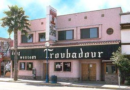
On Sunset we went through Hollywood and Beverly Hills. We saw the art deco Beverly Hills City Hall, as well as Rodeo Drive. (We decided not to drive down it for financial reasons.) We also saw The Troubador, one of the iconic places of rock music. Not much to look at, this place started the careers of many of the big-name music artists.
We finally entered Santa Monica, drove straight down to the Santa Monica Pier, parked and walked around.
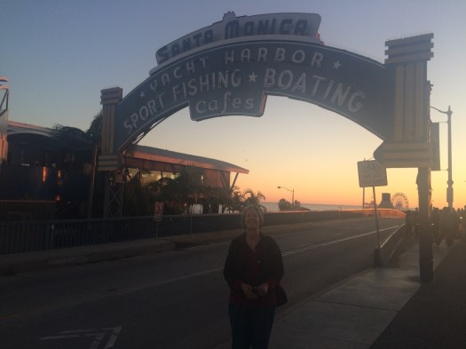
We hustled to get our obligatory, End of the Trail photo on the Pier. (See top of post.) We also took a few more photos.


After looking around the Pier for awhile, we got our car and drove a couple of blocks to our hotel and checked in.
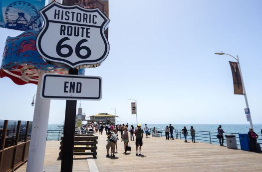
The Pier marks the end of Santa Monica Drive, and thus the end of Route 66 and of our efforts to drive the entire Road. (Yes, there are a few alternate routes that we didn’t cover, but we gave it our best and may come back for more.) From one large body of water (Lake Michigan) to another (the Pacific Ocean), it is a fascinating Road! Our son, Jim, pointed out that Route 66 was established exactly 89 years ago today. We don’t plan to wait 89 years to see it again.
We will be heading to Las Vegas next; I have a meeting there Friday and Saturday. We drop off the car in Vegas and fly back on Monday.
Driving Route 66 is a long-held dream. Experiencing that dream brings new revelations, new insights, and new dreams. We will post again about Vegas, and again later about the high points of driving Route 66, what it means to us, and what we learned. Thank you for sharing the trip with us via this blog. (And thank you for not sharing the trip via car; the back seat of the convertible is packed enough.)
A postscript of Las Vegas, the trip, and more, soon.
