 |
Sullivan, MO to Joplin, MO
When we pulled open the shades this morning it was cloudy, windy, and cool (about 60). With the windows up on the sides and the wind deflector screen up behind us, the Car is comfortable even at that temperature. So we drove with the top down almost all day.


We spent a good part of the morning in Cuba, Crawford County, Missouri. Breakfast (actually lunch) was at the Cuba Bakery and Deli. The place is an Amish bakery, deli, health foot store, millenary shop, community gathering place, and coffee shop. We ate while reading the Cuba Free Press, including the impressive columns entitled “County Felony Reports” and “Municipal Court Docket.” (It appears you are well-served to keep your nose legally clean in Cuba and Crawford County.) We saw a short burst of sunshine at breakfast, but it soon went away.
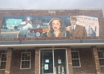
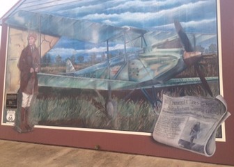 Cuba is also known as “Mural City.” A number of impressive murals adorn the buildings around town, recounting interesting or important events (not always the same thing) in Cuba. One mural told of Betty Crawford’s visit to Cuba, including her husband’s run-in with a local Free Press news photographer. Another portrayed the day Amelia Earhart literally dropped in, making a forced emergency landing. Another touching one showed Cuba’s “Gold Star Boys” from World War II. (See photo at top.) Well-done local artistry, and greatly appreciated.
While looking for the murals, we stumbled across the Wagon Wheel Motel, an absolutely beautiful place we would have stayed in had we know it was there.


We also ran across Joy, who was holding things down at the Cuba Free Press’s office. She was very helpful; she gave directions, didn’t ask if we had any run-ins with the law, and reminded us to stop west of town for the BIG attraction there.
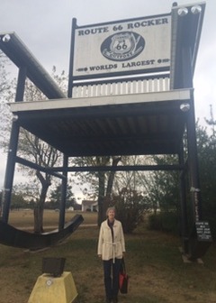
And big it was. The World’s Largest Rocker is located four miles west of Cuba. It is over 42 feet tall and 20 feet across. It appears to be the most photographed “Large Attraction” on Route 66.
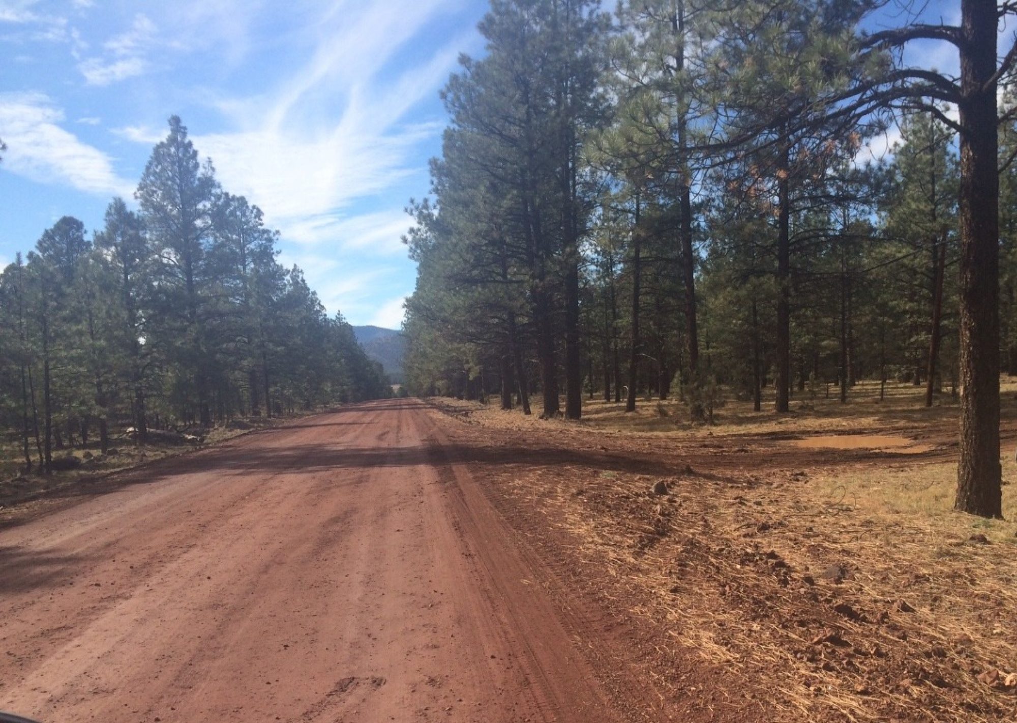
I mentioned before that we stay off the Interstate most of the time. Route 66 adoped a number of configurations over time. When confronted with several options to follow, we pretty much follow the oldest configuration. There are two exceptions to the Stay Off The Interstate rule: (1) if a particular configuration runs alongside (within view of) the Interstate, we go ahead and take the Interstate; (2) when it gets dark, you can’t see anything along the old route anyway so we go over to the Interstate to finish the day’s driving. As we don’t make hotel reservations too far ahead (geographically or chronologically), this second exception rarely comes into play.
St. James, Missouri is in the middle of the state’s wine country. I didn’t know they had a wine country, but they do and they are VERY proud of it. The area is also big in processing apples. We passed some of the wineries but didn’t feel compelled to stop by. We didn’t see any places to stop that had anything to do with apples.
Doolittle, Missouri was named after famed WW II flyer Jimmy Doolittle. The tourist materials did not mention any other connection between the town and its namesake.

Devil’s Elbow and Hooker Cut were fascinating to see and learn about. One of earliest configurations of Route 66 went through an river area called Devils Elbow. The name came from the difficulty loggers had trying to negotiate a sharp bend in the Big Piney River as they floated logs to the sawmill. We drove over the area and crossed the bridge at Devil’s Elbow. The pavement there is concrete and VERY old. As you can see if you study the photos, the pavement has a small upturned lip forming the edge of the roadway. They haven’t built roads like that for years. (I know. I used to build roads.)
We stopped at the Devil’s Elbow “Post Office and General Store.” The General Store was open, but the Post Office had closed at 2 PM so the postmaster could deliver the mail.
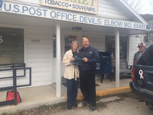
The lady behind the counter asked us to sign her visitor’s book, which we did in return for her taking a photo or two. One of the customers, Dwayne, told us he had worked at Grapevine,Texas, learning how to service copy machines. It’s a big country and a small country.
Hooker Cut was the result of the rough nature of Route 66’s path through the Devil’s Elbow area. The terrain is very hilly and difficult to traverse. As a result, convoys of
 heavy military equipment required an extra day to get through the area. Motivated by the military’s expanded use of nearby Fort Leonard Wood near the beginning of WW II, the government blasted and dug a 96-foot cut through a large hill in the area, allowing the military to bypass much of the difficult terrain at Devils Elbow. So Hooker Cut represents a newer (though not the newest) configuration of Route 66. I took a photo, but this old post-card shows a better view (as it wasn’t taken at 50 MPH).
Following the older routes usually means we go through more twists and turns, as well as more small towns. For example, today we spent all day in Missouri, going to/through:
Sullivan, Stanton, Bourbon, Cuba, Roseti, St. James, Rolla, Doolittle, Clementine, Hooker, Devils Elbow, St. Robert, Waynesville, Laquey, Hazelgreen, Lebanon, Phillipsburg, Marshfield, Springfield, Hallstown, and Joplin.
But we find the oldest routes the most rewarding. They more closely represent what the earlier travelers experienced. The pace is slower, the scenery is more interesting, and the towns and the people are more available for interaction. (See prior posts re Litchfield and above paragraphs re Cuba and Devil’s Elbow.)
North of Springfield we stopped at a state-operated rest stop. We visited with the staff there about where to to and what to see. When we came out the sun was shining. The sky continued to clear for the rest of the day.
We made it to Springfield in time for dinner. We ate at a Route 66 location that has expanded into a large national chain. Springfield has the original Steak & Shake location, and they did a great job with dinner and with taking a photo or two.


Heading out of Springfield, we found an area we had been told about. There are two old “tourist court” businesses that have transformed the individual buildings into small houses. They sit on opposite sides of the street, two small semi-circles of very small. identical dwellings.
After driving to Hallstown on an older route, it got dark and we ran VERY short on gas. Rather than press our luck, we cut over to the Interstate, found a gas station and filled up, and then rode into Joplin for the night.
Marian mentions that the trip is a growth experience for us both. She says we are learing more of how to orient a map with a route that existed more than 70 years ago, how to find the Old Routes without a map (hint: look for the railroad and old telephone posts), how to take selfies, how to pack and unpack, and how to pronounce the noun “Miami” in Oklahomian.
.
